From the blue bays that remember the steps of fishermen and sailors, to the rugged heights of Orjen that preserve the silence of stone and munica - Herceg Novi is a place where nature, tradition and everyday life form a unique combination.
Cape Oštra on the left and the island of Lastavica on the right are used for orientation when entering the territorial sea of Montenegro, that is, entering the Bay of Kotor.
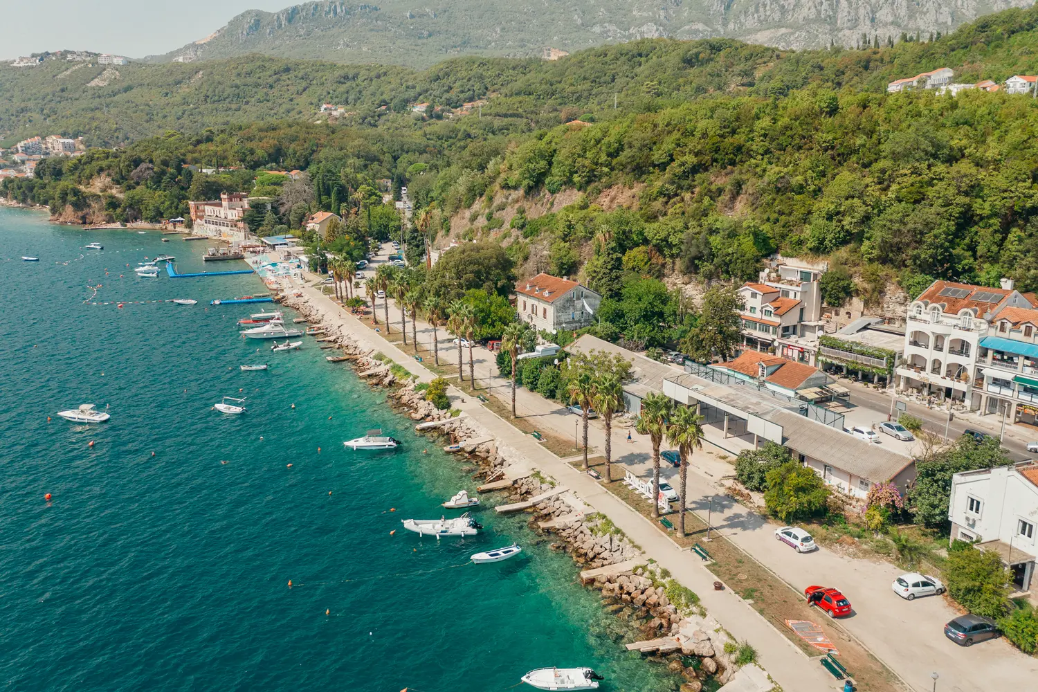
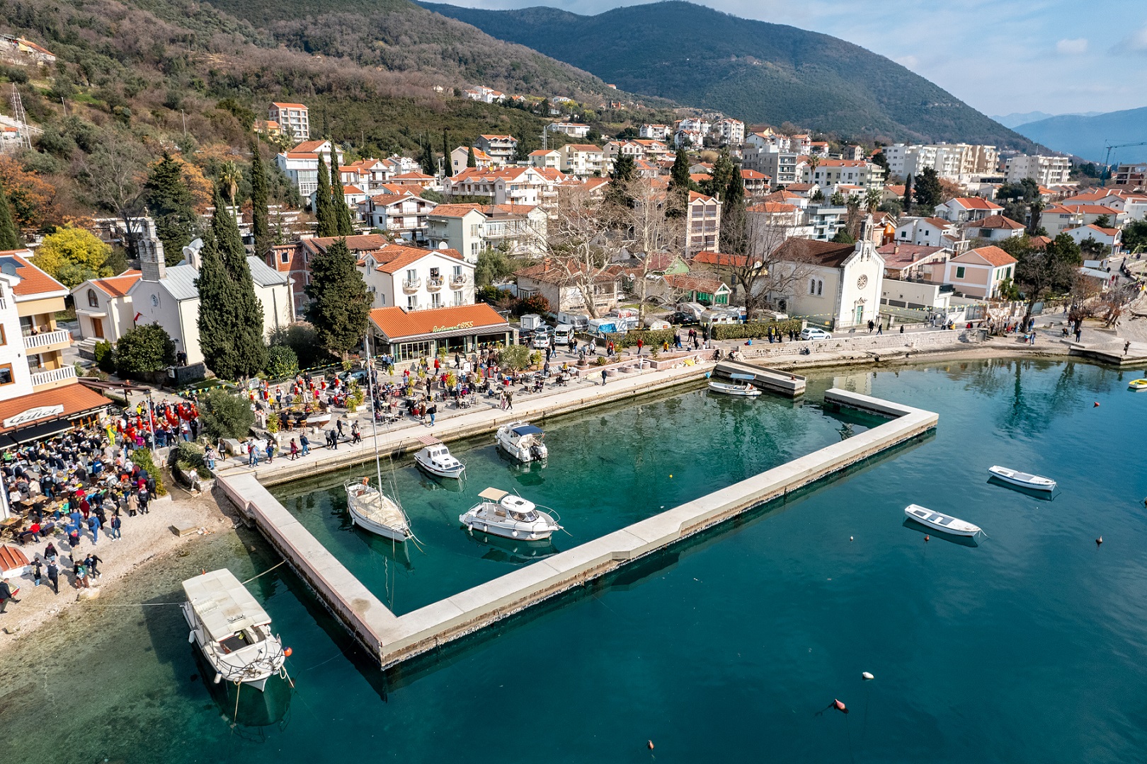
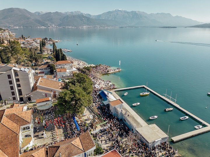
Going along the coast, three kilometers to the east of the center of Herceg Novi is the settlement of Meljine, with a one kilometer long sea coast. The settlement was mentioned even before the founding of the city of Herceg Novi, as the port of Dračevica, in a Dubrovnik document from 1371. Until 1936, Meljine had a Port Authority. One of the oldest and best-preserved lazarets on the Adriatic is located in Meljini, today a hotel and marina. The Meljin hospital was built in 1729, and in 1741 water from the Savina was brought into it.

The village of Zelenika is located at a distance of four and a half kilometers east of Herceg Novi, with a two kilometer long sea coast. The name of the place comes from the Mediterranean evergreen plant zelenika. Zelenika is the forerunner of organized tourism in Boka (the "Plaža" hotel opened in 1902 was the first hotel on the Montenegrin coast), as well as an important port and station of the former Zelenika-Sarajevo narrow gauge railway. North of Zelenika is the village of Kuti, which was first mentioned in 1450 during the reign of Stefan Vukšić Kosača, and got its name from its specific location, from the word kutak.
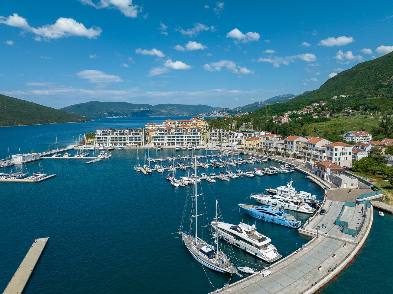
Going further east, six kilometers from Herceg Novi, there is the village of Kumbor. It got its name from the Italian word "conborgo", which means suburb (the tradition says that Kumbor was a suburb of the old city of Stoli, which sank in an earthquake). Kumbor is mentioned as Combur in Venetian documents from 1758. The former military base in Kumbor, a closed and strategic zone for decades, has today been transformed into one of the most prestigious tourist complexes on the Montenegrin coast.
Going further along the Adriatic Highway, eight kilometers east of Herceg Novi is Đenović, a settlement that according to legend was inhabited in Greco-Roman times, as the Greek settlement of Stoli (Stolium), an old town that sank into the sea, probably due to an earthquake. Even today, the locality on the west coast of Đenovići is called that. Today's name Đenović (Gioneoevich) is mentioned for the first time in Venetian documents.
Twelve kilometers east of Herceg Novi is the village of Baošići, two kilometers long. According to one tradition, the place got its name from the Balšić family, who lived in this area, and according to another, from Baoš Cvjetković, who settled here from Zeta in 1590. The maritime tradition of this place is evidenced by the fact that during the flourishing of seafaring in Boka, the Baošići in one period had over 30 long-sailing ships and over 50 sea captains.
Bijela is 13 kilometers from Herceg Novi Bijela, in the direction of the east. The place is first mentioned in a Kotor document from 1333 under the name Sankti Petri (Saint Peter), within the Kotor district, while in a document from 1355 it is mentioned under its current name - Bijela. Actually, Sankti Petri was the name of the locality where the Benedictine monastery and church were located, and today that locality is called Rake. The name Bijela is probably related to a spacious and fertile field along which flowed a stream called a river (hence the name of the locality Podrijeku). There are indications that Bijela belongs to the parish of Dračevica, that is, its central place within the parish. The place is recognized for its maritime and shipbuilding tradition, which continues today.

At the beginning of the Verige strait, 15 kilometers east of Herceg Novi, is the village of Kamenari. It got its name from excellent stone carvers, stone masons. Many churches and palaces on our coast, as well as in Venice, were built from the widely known red stone from the hamlet of Đurići in Kamenari. From there, the ferry transports passengers through the Verige Strait to Lepetan, on the other shore of the Bay of Kotor. Verige Strait is only 350 meters wide, and it is the narrowest strait in the bay. According to the records, it got its name from an unfortunate event in 1624, when pirates from North Africa sailed into Bok and ravaged Perast. After that event, according to tradition, the people of Perašta and Kotor, in order to protect themselves from sudden pirate raids, developed an iron chain from one shore to the other in the narrowest part of the strait.

The Luštica peninsula, although on the other side of the bay, is part of the Novi Riviera - with its life, stories and landscape characterized by olive groves, stone villages and quiet coves.
The peninsula is located southeast of Herceg Novi, on an area of 47 square kilometers, with a length of 13.2 kilometers and a maximum width of 5.9 kilometers. It is connected to the rest of the Montenegrin coast by the Adriatic highway via Tivat. According to tradition, the name Luštica was given because it looks like a shell, and according to another interpretation, it comes from the word lug (luški). It is mentioned under that name for the time of the Serbian king Radoslav (1223-1234) who donated Luštica to Kotor, and later that donation was confirmed by Emperor Dušan. Luštica also existed as a separate municipality in the period from 1826-1944. year, after which the larger, northwestern part belonged to the territory of the Herceg Novi municipality, and the southeastern part to the Tivat municipality. It had the image of Saint Michael the Archangel on its seal. The beginnings of schooling in this area, in Radovanići, go back to 1879. Today, there are 19 active churches on the peninsula, which are also extremely valuable cultural monuments. In the village of Radovanići there is one of the oldest churches in this area, the church of St. Nicholas, which according to tradition was built in 1117, and the same tradition says that it was consecrated by Saint Sava.

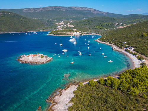
On the northwest coast of Luštica is the small fishing village of Rose, 1.7 nautical miles from Herceg Novi. Rose is a typical Mediterranean town with houses that are close together and lined up in front of the pier - the waterfront. Once upon a time, this was the old Greek settlement of Punto Rosa, which was destroyed by the Saracens (that's how the Europeans called the Arabs in the Middle Ages) in 867. Roses are also mentioned in the records of the Byzantine Emperor Constantine Profirogenitus in 841. Due to its position and protection from the winds, in the past, Rose often served as a shelter for sailing ships, and at one time there were customs and the harbor master's office, as well as a quarantine for sailors entering Boka. Roses were mostly built in the 17th and 18th centuries, during the period of the golden age of seafaring in Bokele, when many people from Luštić sailed the Mediterranean and other seas of the world in their sailing ships. In Rosa, there is an Orthodox church of the Holy Trinity, around which is a cemetery where famous sea captains are buried. There is also the Church of the Holy Virgin, built in 1783 by the Venetian general Antonio Alberto. Throughout the year, Rose is connected with Herceg Novi by a permanent ferry line.
The whole of Rose, as well as the Luštica peninsula, are laden with archaeological excavations, and hydro-archaeological excavations are particularly interesting, where cannonballs, anchors, ceramics were found, as well as an old Spanish ship from the beginning of the 16th century, which was shipwrecked while transporting ceramics for the Bosnian dynasties.

South of Ros, at a distance of about 2.7 nautical miles from Herceg Novi, there is Žanjic bay, surrounded by old olive groves and lush vegetation. The beach in the bay is protected from strong waves by Cape Arza, over 300 meters long and up to 15 meters wide, with white pebbles, and there are restaurants along the coast. Directly next to the beach is the church of St. John, which dates back to 1881, and was built on the ruins of the old church of the same name. In summer days, the bay can be reached by a regular boat line, as well as by numerous vessels that transport excursionists. Between Žanjica and Cape Arza, i.e. the fort of the same name, there is Mirište bay, also one of the favorite destinations during the summer. Near Arza is the Žanjic islet, colloquially called Mala Gospa, and on it is the monastery-church of the Presentation of the Blessed Virgin Mary.
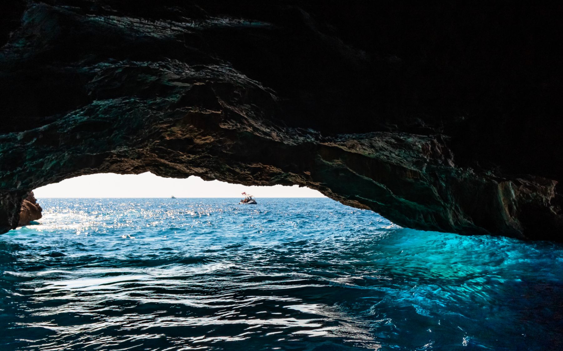
Between Zlatna luka cove and Mokra gora cape on the Luštica peninsula is the Blue Cave, about 5.6 nautical miles from Herceg Novi. One of the most interesting natural formations of this kind in the Mediterranean, it was created under a cliff about 30 meters high. The cave has two openings - the higher one of about 4 meters is located on the southeast side, while the other is much smaller, on the southwest side. The interior of the cave is almost round in shape, while the ceiling is in the form of a vault. There are about 9 meters from sea level to the top of the ceiling, and the depth of the sea is between 3 and 4 meters. The surface of the cave at sea level is 100 square meters. During sunny summer days, especially in the morning, the sun's rays bounce off the surface of the sea and reflect into the interior of the cave, through a small opening, giving the sea and the vault of the cave a specific shade of blue, which is why it got its name Blue Cave. The cave is entered by smaller vessels, and swimming is a special experience that visitors come back to again and again and look forward to.
People from this climate, especially sailors, brought a wide variety of plants from their long journeys, so, along with the local Mediterranean flora, Herceg Novi is rich with over 200 types of different tropical and subtropical plants. You will find such species in the park of the former "Boka" hotel, in the center of which is a fountain with a sculpture of the goddess of hunting (work of sculptor Petr Palavičini), as well as in the park-garden of the City Museum on Topla, the palace that Mirko and Olga Komnenović left to the city. The city's green oasis is the Savinska dubrava park - winding paths through a dense forest located on a limestone ridge.

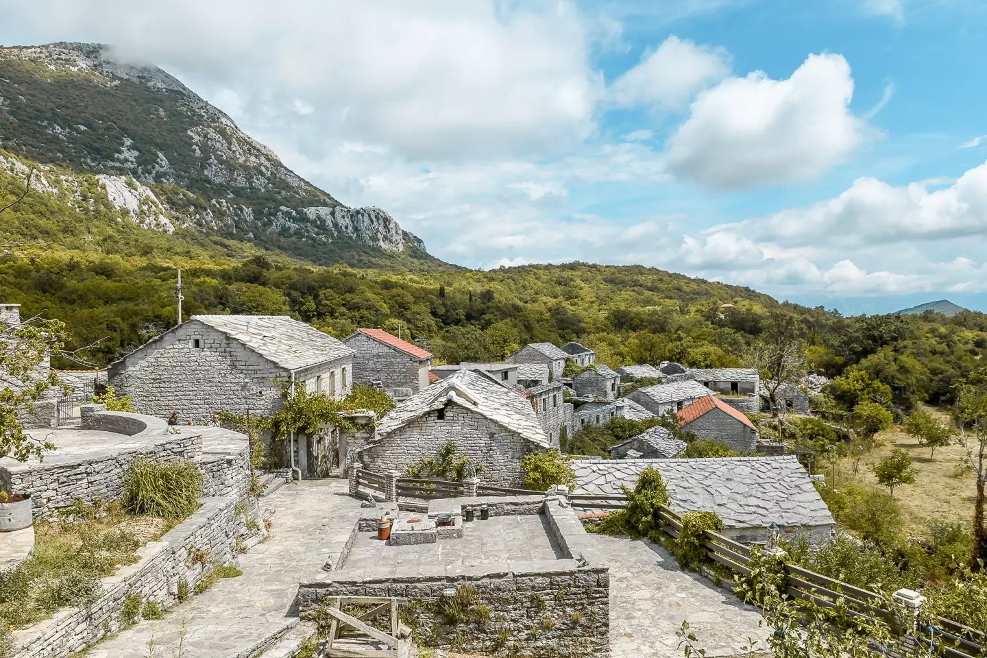
The hinterland of Herceg Novi reveals a different but equally rich dimension of this region, where nature and tradition live in harmonious symbiosis. The Orjena massif rises above the city, and at its foot are villages with a rich history and numerous family farms, which offer an authentic view of life, outside the hustle and bustle of the city.
The Orjena massif is characterized by harsh beauty - the central part is full of stone plateaus, cracked rocks, etc deep pits, and the mountain, along with the gray limestone, is also filled with the green color of dense forests. The massif covers over 400 ha, it extends over the territory of three states and five municipalities. Orjen is home to the highest peak on the Southern Adriatic - Veliki Kabao (1895 m.a.s.l.), as well as a locality famous for the most interesting detail of the coastal Dinarides, a fantastic formation of geo-heritage - the 300-meter high cliff of the Subra Amphitheater.
The etymology of the word Orjen is of Latin origin and is assumed to be from the time of the creation of the Eastern Roman Empire. According to tradition, in good weather Orjen can be seen from the western coast of Italy (Gargano) and it is the only peak on the eastern coast of the Adriatic Sea that can be seen from Italy, so for the Romans it was an eastern navigation landmark - lat. "oriensentis" means to rise, grow, come out. The local dialectal transformation of this Latin toponym gave it its current expression, Orjen.
Mountaineering on Orjen emerged as a recreation and sport gradually during the Austro-Hungarian rule in this region, and as a separate activity after the First World War. The arrival of the heir to the throne, Prince Rudolph Habsburg, who as a mountaineer and a passionate ornithologist during a private visit, went to the top of Orjen was recorded. Today, the hinterland of Herzegovina has a very extensive and high-quality network of marked mountain trails, some for hiking and some for walking, most of which are located within the Orjen Nature Park.
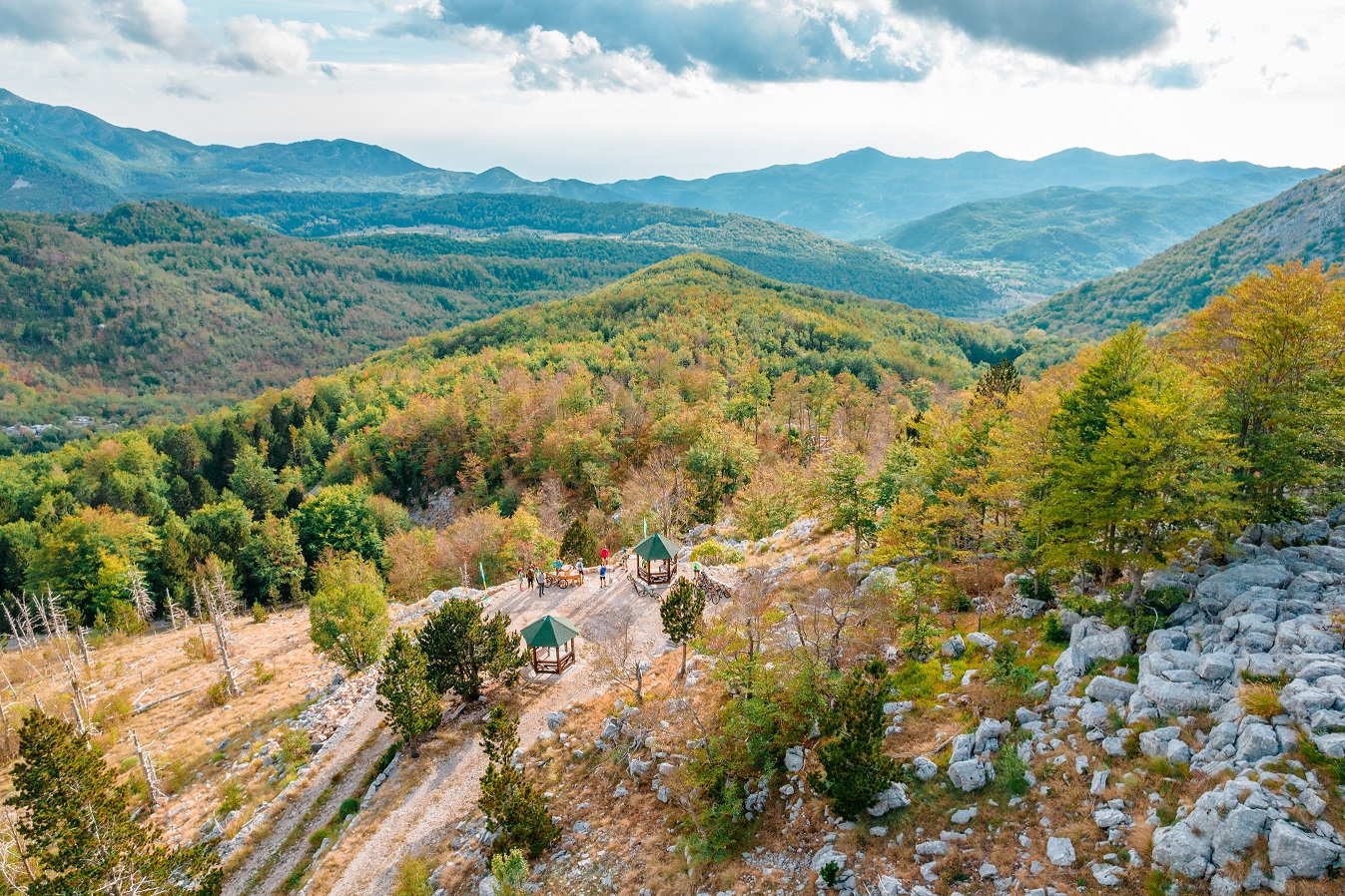
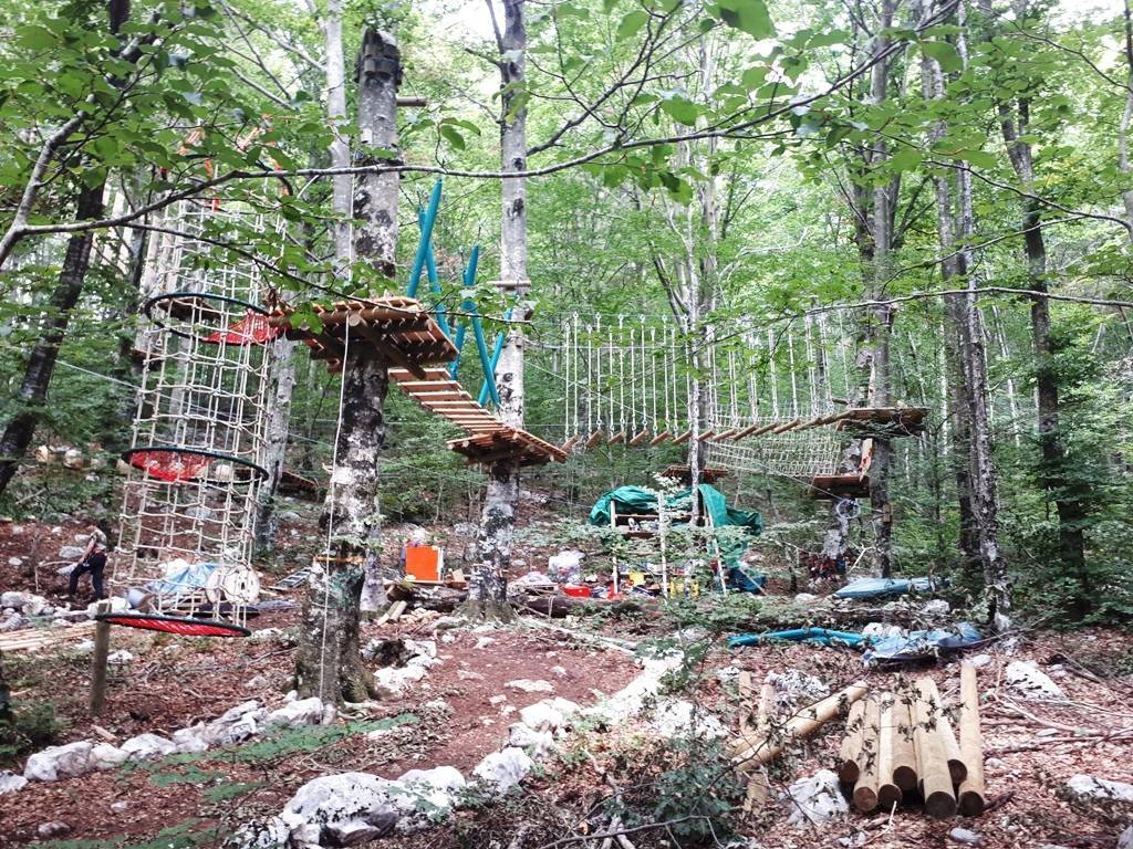
The most famous picnic spot in the hinterland of Novi is the village of Vrbanj. There is also an adventure park on Vrbanja, built in a beech forest, respecting all environmental protection standards and using only natural materials. The park is located at 1100 m above sea level and is one of the most modern adrenaline parks in the region. On seven thousand square meters, there are five polygons with 44 elements and a 200-meter-long zip-line. The polygons are divided into categories - from the easiest, adapted for children from 6 years old, to the most complicated, adapted for slightly dexterous and more experienced users. Within the park there is also a zone for rest and recreation.
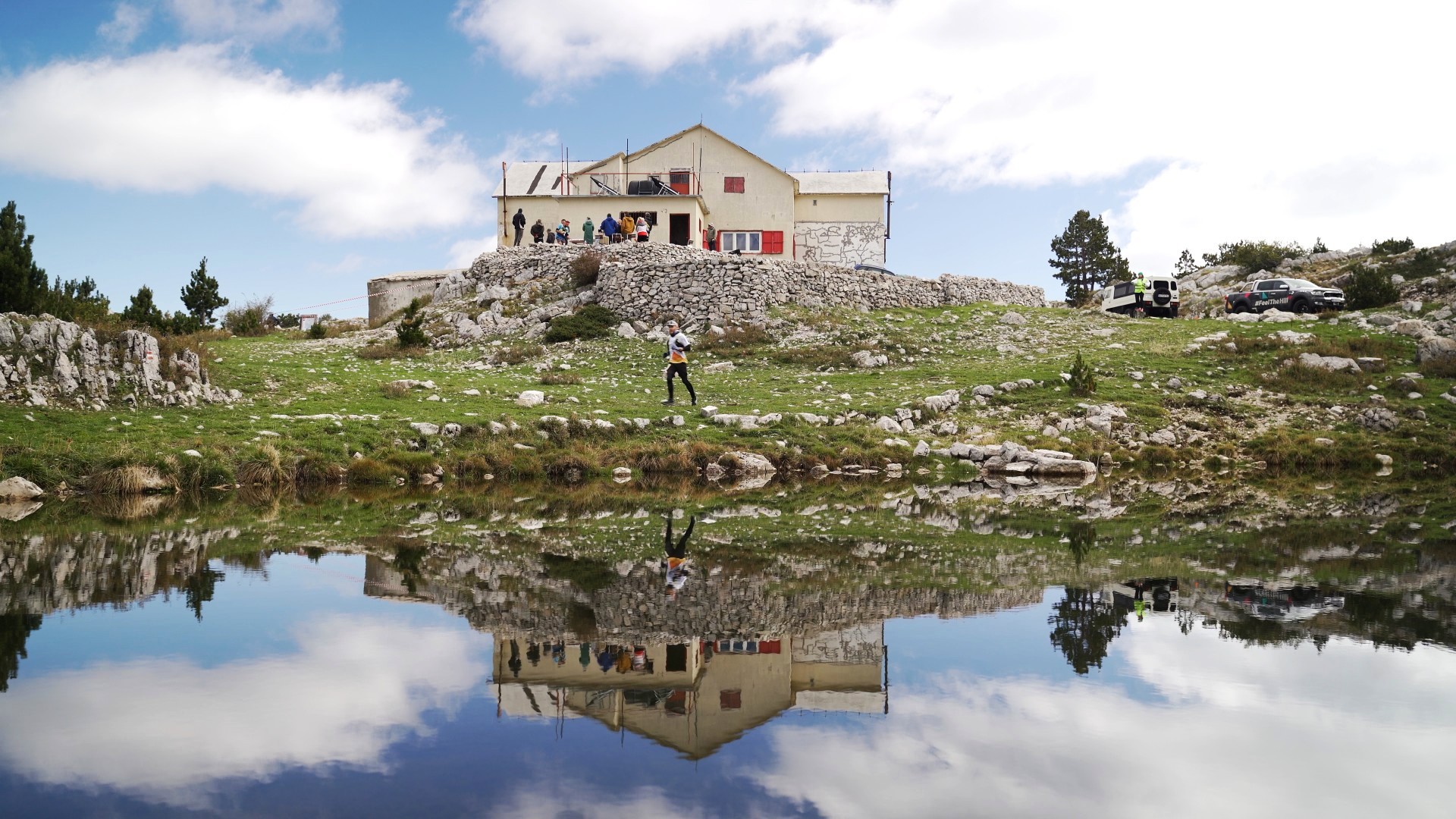
At 1160 m.a.s.l., about 15 kilometers from Herceg Novi, there is a mountain lodge "Za Vratlom", managed by the Mountaineering Club "Subra". The facility has a capacity of 50 beds, with water and electricity, and marked trails lead from the house to some of the most attractive destinations on the massif.
An attractive destination is the village of Žlijebi, which, along with the asphalt road, leads to the old serpentine footpath, with many beautiful viewpoints. The Serpentine and the village are united by the same architectural heritage and the same local sedimentary stone, from which everything was once made without binding material: from borders and roads, to houses and roofs.
More information about the Nature Park: https://orjen.me